
MEXICO to OREGON LOG
DAY 52 San Diego KOA to Sacramento KOA 20.63km biked/ 551miles per car JUNE 20/ 01 WEDNESDAY
Decisions made... cycled back thru San Diego and rented a car to fill with bikes, to go to Sacramento. Had no trouble finding the Airport, but a nice retired fellow biked with us to find Budget Rent a Car... very reasonable, although we didn't disassemble our bikes until in a parking area away from the rent-a-car!... we were careful not to mark the car!
We headed off... Trucks +++ going I 5 north.. really glad not to be on the road... 105F HOT... went thru Angeles National Forest... the tumble weed was the only vegitation, no trees, therefore no shade! Out of Santa Clarita, 4144ft elevation gain (2000ft rapid) Once the 5 miles down over, the way was very flat. I am very tired of the sound of traffic! Cross stitch is coming along! We came across a feed lot with millions literally of cattle that went on for many miles and the cattle had no grass underfoot... must have been pellet fed. Gross!
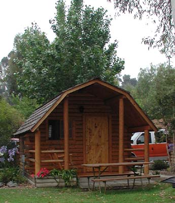
We found the KOA with no trouble on a small lake (water resevoir) It was getting dark so the other camping we didn't assess. The pizza quick supper, tent up in the dark and off to bed. We did drive thru Old Sacramento, but decided to visit it another time. Tourist infos avid us!
20.63 KM 1hr20 min ride time M 31.9 A 15.4 TD 3641.01 KM OD 7101.9
KOA cute cabins
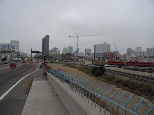
San Diego entry
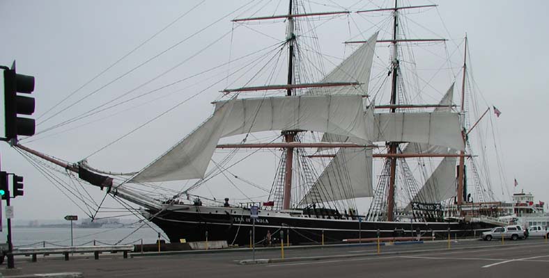
Star of India
I 5 Trucks and more trucks
DAY 53 Sacramento KOA to Colusa Sacramento River State Rec Park 96.72 km JUNE 21/ 01 THURSDAY
Well it was expected to be another hot day so up early as we had to go to the airport to return the car and reassemble our bikes... just the front tires to put on as the back seat folded down.. but it takes time to pack up from the car... of by 0830. Already +20C (gas $1.89/gal)
Investigated and found we could go on I 5 to cross the Sacramento River, then off on side roads. Just as happy to leave it as it was full of trucks. Headed north from Woodland on E8 (hwy 102) to Knights Landing and on to Grimes. Looked on the map as if it followed the river... guess again no shade, +40C (107F) no wind! except that made by cycling which did help...could have fried an egg on ME! let alone the road. Best thing was it was flat like Saskatchewan and 0 traffic.
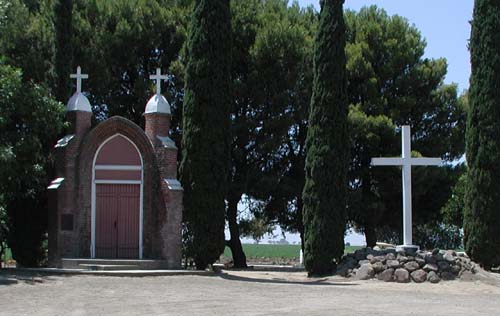
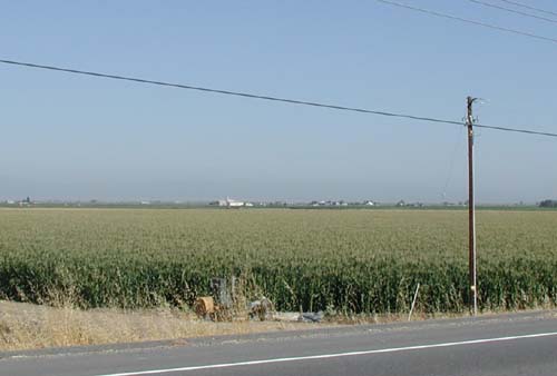
Arrived early to our destination of Colusa, but needed to stop with this heat. Lots of Spanish spoken along this route, lots of farming (safflowers, sunflowers, rice, corn, tomatos, peppers) Stopped at a Catholic historic church shrine (1785)... Paula I registered you in the prayer book.
The campsite is very nice, no need to use the solar heated hot water!, cold was great. They had the sprinklers going, reminded me of Thacker Rd sprinklers on the grapes. Ken got us Corona for treatment of heat stroke and many gallons of cool water. Need I mention that the weight of it must have caused his 4th flat!! We hope to be off early tomorrow as the heat wave is to continue. The Mosseys are horrific and some minute black fly. The fireflys are having a feast!
96.72 KM 4hr57 min ride time M 31.1 A 19.4 TD 3737.73 KM OD 7198.6Roadside Shrine
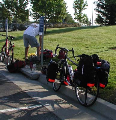
Bike reassembling
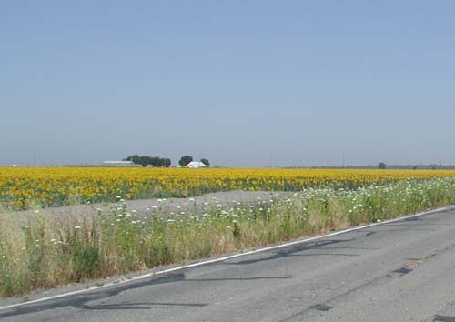
Sunflower fields
DAY 54 Colusa Sacramento River State Rec Park to Woodson Bridge SRA 112.49 km JUNE 22/ 01 FRIDAY
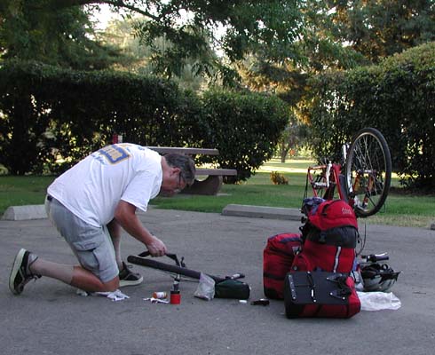
Well as yesterday up early expecting to get off on an early start... not to be as the patch Ken applied to the self sealing tube did not stick. It really wasn't a new flat as these special tubes just won't allow a patch to stick... definitely not worth the extra money.
We still are not going up along the river as it appears on the map, although we did see the river at one point. They are using the river to irrigate all the crops with a ditch system and flooding rather than sprinklers. Phenominal water usage, but they do reclaim water and reuse it. Today: walnuts, almonds, rice, corn, tomatoes, wheat, and few cattle. It was once again very warm (42C = 107F) We lunched at a High School in Hamilton City one of the few we have seen without a guard and fence. Been drinking copeous amounts of water with a constant drip down my back of sweat. The traffic was a little more, but still a nice ride. We finally gave up on the tube and Ken used his spare after lunch out on the shadeless road.
We talked to locals to find out that there is an old hwy 99 paralleling I 5 that is not on our map, so we took that from Orland to Corning. It is very tough after going into the Subway for a cold drink in the airconditioning, to return to the black pavement. We made it to camp and this time it is along the river. Ken once again swam, but it was very cold and I opted for a cold shower and a sit on the beach.
The blue Jays attack our table if you leave it for even seconds! So far the Mosquitos seem less. We still don't know how we will get to Weed as I 5 appears to be the only road. It is different traveling with out the aid of the tour book, but we will succeed! I think we are definitely in summer as Ken slept last night without his long johns and maybe once again tonight! Oh Yeah! I am getting tired of the heat which I never do! We should be in the mountains tomorrow and get a little relief....then just hills!
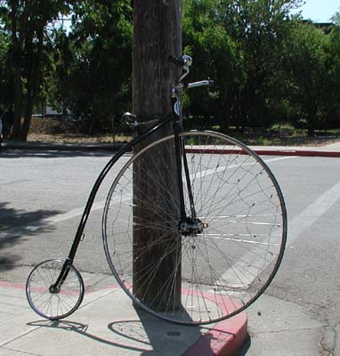
112.49 KM 5hr54 min ride time M 47.9 A 19.0 TD 3850.22 KM OD 7311.1Cool bike at repair shop
Oh no not a flat!
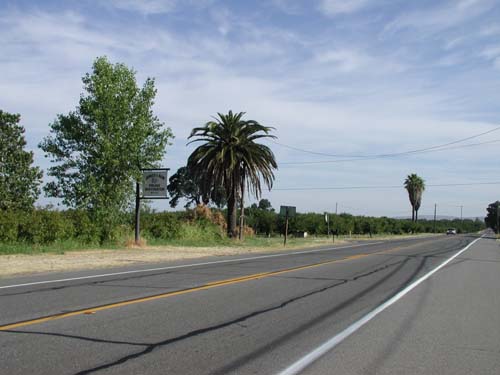
corn fields
DAY 55 Woodson Bridge SRA to Shasta Lake 127.94 km JUNE 23/ 01 SATURDAY
Oh my tired bod!!! Another very hot day (90F +35C) Not complaining, but I'd rather be at the pool in this heat. Not a lot of camping places in this area and we wanted to get to Shasta Lake in hopes that it would be cooler in the mountains.... not so!
Uneventful flat ride from camp to Red Bluff. Tried to get information on riding on I 5 the freeway from a. Welcome to California Tourist info (ride on it) b. bike shop (ride on it) c. Sherriff's office (unsure) d. other biker (ride on it, but get harrassed by hiway patrol) So when it says Pedestrians Prohibited we ride if it says Bicycles Prohibited we look for another route. It would be a lot easier if we could get a map with the side roads. On and off I5 to Anderson, then took a side hiway 273 with shoulders, but rutty. No constant truck noise was welcome.
After Redding we lost the road and went on I5 with Bicycle Prohibited sign... in not too long the hiway patrol came zooming by and spoke over his speaker "Your Not Supposed to Be Here!" but he didn't stop and we had no other choice but to pedal on. The elevation started to climb, which wasn't called for in this heat! Anyways we got to the lake and guess what ... tiny,tiny shoulder on the bridge with 2 lanes zooming by at 65mph! Go for it I did and got to the other side unscathed once more!
Came to the campsite to find it full... expected on a Saturday nite... but all the other state parks have a space for bikers... not so here... 2 motercyclist tried to talk the host into finding some tiny space for their tents... I took another approach... See if a camper can resist my charm and refuse to sublet a small space to this tired looking woman. We found a really nice couple who were sleeping in their truck box, so the tent area was for lease! They seemed happy to get the $8 for half the site too. As there were no showers I succumbed to a dip in the lake which was quite warm and clean. To bed late as a long day. This was our 28th Wedding Anniversary...no better way to spend it!...together.
127.94 KM 6hr48 min ride time M 46 A 18.4 TD 3978.16 KM OD 7437.1Prune Drying factory
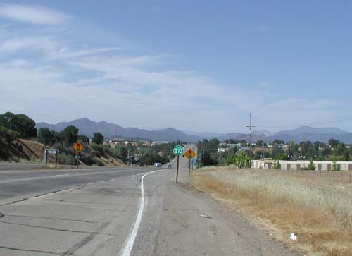
View of coming hills
DAY 56 Shasta Lake to Weed 87.05 km JUNE 24/ 01 SUNDAY
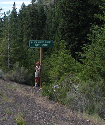
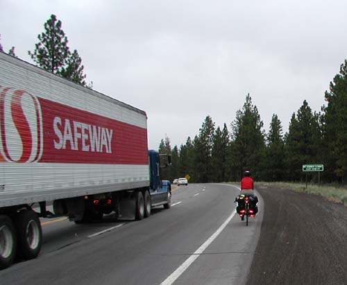
Up early as usual. 15C at 7am... could have been another warm one..a few clouds helped keep it not too bad... 25C most of the day and cooling off tonight. I 5 is our only choice and the constant roar of the trucks is unbelievable. The road was rolling with a 6% grade so not too difficult going from Redding at 560ft elevation yesterday to Black Butte Summitt today at 3918ft. Although I was glad to reach the summit! Not a lot of speed on my uphills, but stamina still there. Very little in the way of flowers along the road... desert grassses.
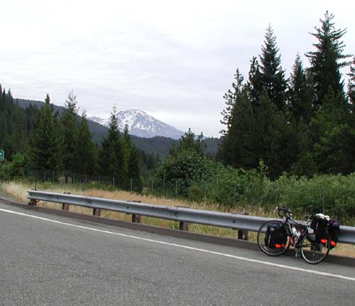
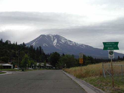
Mount Shasta loomed ahead of us most of the day. It has snow on it still, even in this heat. We toured thru the town at the foot of the mountain (Shasta City) which is quite large and full of nice looking motels for the winter season, rather quiet now. Lots of "shops" or businesses related to Wellness of the body and mind... retreats and soul searching institutes. Very different.
I'm a little concerned about my family. If your reading this email me! I'm not getting any home news! Feeling a little cut off. We had a expensive lesson using our Telus Calling Card.. checked our bill to find a few calls we made we not on AT&T... $10. per minute! are we on the same side of the world?
I will be so happy to leave I 5 tomorrow for Hwy 97. I sure hope the truck traffic all stays on I5. We will have more climbing to do. Camp at a Good Sam RV Park/campsite.
87.05 KM 6hr16 min ride time M 42.8 A 13.8 TD 4065.21KM OD 7524.1Shasta Lake
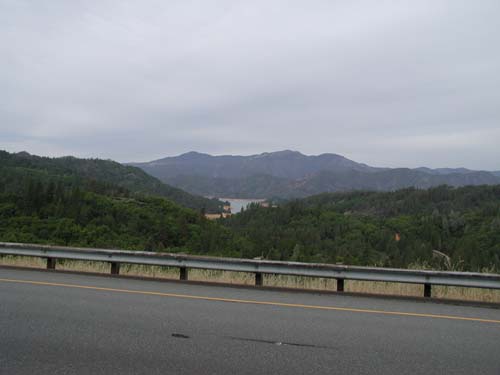
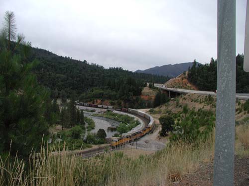
I 5 and Train
Mount Shasta
Black Butte Summitt Yeah!!
DAY 57 Weed to Doris CA 89.63 km JUNE 25/ 01 MONDAY
Slept later as much quieter site in South Weed. Off to find the end of 97, but no sign to indicate its end nor even a shop with that name... strange they haven't capitalized on that. Very quiet town with a lot of truck traffic on both hiways. The cooler day is refreshing. I'm getting tired of wearing the same clothes even though we did the wash! A girl thing!!
Gradual up, up thru dry forest area. No underbrush, but Indian Paint brush in bloom. Loud crickets and less trucks! Loggers on the road. Bee boxes just off the road . No sign of homes. Very stark rather plain road to cycle. A little cooler so wearing a vest. Beautiful tan is starting to peel!
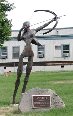
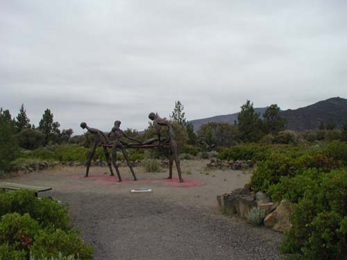
Visited the Living Memorial Sculpture Garden which was at the crest of a hill looking over at Mt Shasta. It left me with a disturbed feeling. It is not a war memorial exactly more a anti war or a memorial to the misery war produces. The scultures are metal and set in small circles throughout a reforested area. The site is very peaceful, but the sculptures were made by a vietnam vet who depicted the pain of the war. Thought provoking. They have a web site which I have not visited yet, but here it is http://www.livingmemorialsculpturegarden.org
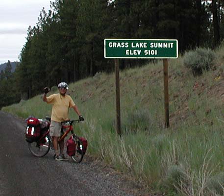
The miles didn't seem to fly by today with the continual up up. At 3hr15min only 38km done (A12 M40) so I quess it was steeper than I thought. Did reach 2 summits: Grassland 5101 then down again and up to Mt Hebron Summit 5202ft Didn't think we would ever make it to camp, but suddenly on a plateau valley of Wheat fields. The irrigation sprinklers were on and the farmers were out harvesting. The speed increased and we did 50k in 2 hr. It was overcast and a misty rain started, so as no campground appeared we stopped at a very nice reasonable motel (Golden Eagle) in Doris at the California border. Planning to do a short day tomorrow unless the rain sets in.
89.63 KM 5hr33 min ride time M 50.5 A 16.1 TD 4154.84 KM OD 7613.8Weed CA
Mt Shasta
Sculpture in Weed
Living Memorial Sculpture Garden: The Nurses
Summit Grass Lk
Mt Hebron Summit 5202