
OREGON TO WASHINGTON STATE LOG
DAY 58 Dorris CA TO Hagelstein Klamath County Park 54.89 km JUNE 26/ 01 TUESDAY
Today is my sister Lorna's birthday. Hope you had a great one! Your catching up to me!! Hope both my sisters and families are having a good cycle tour thru Banff/Jasper Park. They should be on the road as we are. Thinking of them as we pedalled along today.
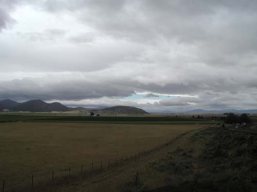
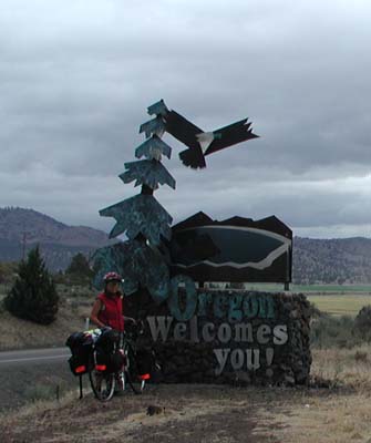
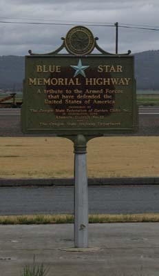
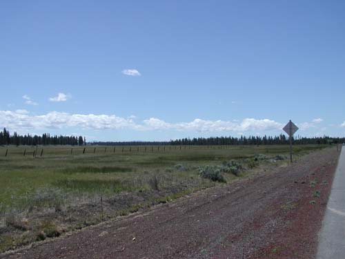
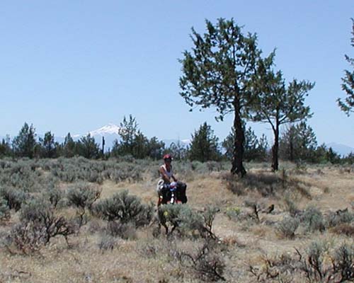
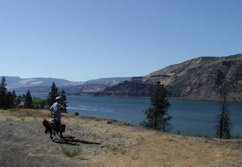
Enjoyed our night at the Golden Eagle Motel. Two of the friendliest motel managers we have ever met. We headed off to Klamath Falls. Highway 97 is called the BLUE STAR HWY or Vetran's Hwy for all the vets in the USA. Maybe Canada should continue this name? Another name we were told was Alcan (Alaska-Canada Hwy) Anyways started out with a slight grade out of Dorris (town of 1000) to a basically flat ride along the irrigation canal. Lots of ducks with ducklings in the canal. Interesting signs posted along the way "No water, No Barley, No Beer" and others related to the water crisis. We stopped in the Oregon Visitors Center to finally get a Bicycling Guide Map!! It is terrific. Shows the hills direction and the roads are color coded as to amount of traffic, if has a shoulder, etc Hope we can get one for Washington too. Got lots of interesting info and have decided on some side trips as Klamath Lake turned into a disappointment. It is not a lake like Okanagan as it looks on the map, it is a swampy ?irrigation lake. So much for spending a few days here.
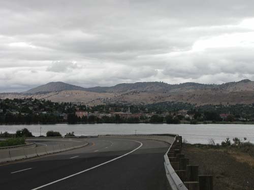
It is raining... drizziling so will head to Crater Lake for tomorrow and Thursday. It is supposed to hardly ever rain here. 13 inchs a year with 300 days a year of sunshine. Guess we have hit the days of rain. We stopped in Klamath Falls (don't know where the falls are) and had a great lunch and stopped in the library for internet. We were glad to here from our son Keith. We are missing our families. I think we have decided 3 months is a long time to be away.
The water issue is very big here. Apparently it has to do with the "sucker fish" and another fish being put on the endangered species list, therefore they cann't use as much water from the streams as usual. The farmers are suffering...if they don't irrigate everything is dry tumbleweed. The valley is very green where they are irrigating and taking off crops of barley, wheats and strawberry plants. But where not, it is dry, dry. They are not watering their lawns like in the south. Well I'm in the tent and dare I say Ken is fixing yet another flat! Who knows the stats on who gets the most flats and on what size of tires. He says I just have horse shoes up my ...! May be !
54.89 KM 2hr58 min ride time M 42.8 A 18.4 TD 4209.73 KM OD 7668.7Butte Valley, Dorris CA
Oregon line
Blue Star Hwy
Klamath Falls
DAY 59 Hagelstein Klamath County Park to Crater Lk 93.66 km JUNE 27/ 01 WEDNESDAY
Rained all night, but windy too, so the tent is dry. 7am = +10C (50F) Cold! Cloudy and looking like rain. Highway was a bit noisy, but we slept well. Guess if your tired enough! Just as leaving camp a gentleman who just retired (64) road into camp lightly loaded (15lbs) He was cycling to Portland for a wedding on the weekend so going over 4 days ~100miles/day. Tail wind today should have helped him meet his goal, sure helped us!
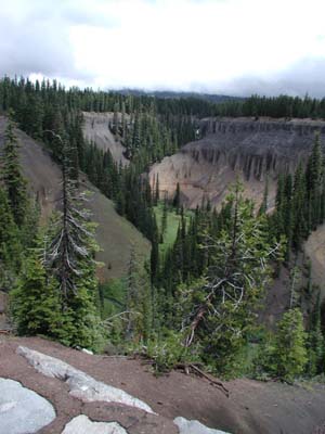
Area directly out of camp, along North Klamath Lk narrow to no shoulder for the first 10k with cement guard rails to keep back the fallen rocks. Pedal faster! Was very flat until Fort Klamath on Hwy 62. Had hoped there was a fort to tour, but nothing to see left. The National Pk starts the ~3% grade up for 15miles, never seems to end. 2000ft gain, but of course some is saved for the last 7 miles to the top of the crater.
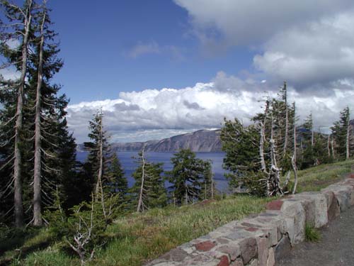
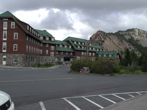
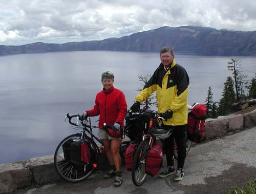
We were a little disappointed that the campground is 7 miles from the lake, but we set up and pedaled up to the summit of 7100ft (550ft in 3m) to a spectacular view of the lake in an "imploded" volcano. It is the deepest lake in the USA (1958ft)at an elevation of 6176ft. There is a nice lodge that they have restored and other buildings they are working on. Ken wanted to stay the night so asked the cost ($115-169) not bad although in 1934 could have a room for $6. They get a lot of snow up here (~44ft/yr) so crosscountry skiing is big. It is not glamourus like Lake Louise lodge, but very nice. The down hill ride was exilarating! Got back to camp to a chipmunk had eaten some of our bread.. at least he didn't chew my sleeping bag!! Side zip of tent was accidently left open.
We will do the summit again tomorrow loaded (1100ft gain in ~ 10k) It will be a grind, but the down will be great. Rained just as we got back to camp so everything is mucky. Hope it drys by morning.
93.66 KM 5hr48 min ride time M 46.4 A 16.1 TD 4303.39KM OD 7762.3Gorge to Crater Lk
Crater Lk
Crater Lk Hotel
DAY 60 Crater Lk to Crescent 104.13 km JUNE 28/ 01 THURSDAY
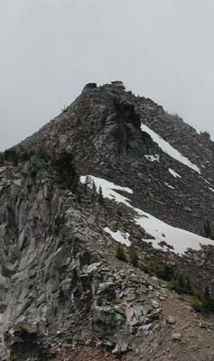
Well it didn't dry out...it rained all night! Stopped for us to pack up a wet tent but dry gear. 11.06km to the crater village where we had coffee. This took 1hr7min! as it is up up up.(6450ft) M26 A9.8 What a grind! It was only 5C in camp and 10C at the village. We started off on the Rim Road to discover it isn't flat... more up!! As we rounded Watchman Mtn 8013ft we must have been at 7400ft and then it is rolling up and down for 10k The views we really great. I would love to come hiking to this park. The Pacific Crest National Scenic Trail passes right by here. We will have to investigate doing some of that as another adventure. The decent starts at 7025ft to hwy 138 at 5850 over 10km. Wow that was fun!! Not too many cars. Got our speed up! Then another 25km of mostly down to Hwy 97 (4609ft) That was a great down.. too short.
The road pass by pine forest that could be anywhere around Edson. The sun came out and we dried the tent while eating lunch and continued on. We decided to go to Crescent town which was farther than we planned, but all the other campsites were off the road.
The sun came out and it is a lovely evening. we spoke to a local and saw some photos of the tons of snow they get each year. There is a very popular dog sled race held in Chemult every year. I was very surprised to here they have so much snow. The RV park warns that they can get down to freezing any night of the year, so to watch your water lines! Not a problem for us. Ken is back to long johns!
104.13 KM 5hr30 min ride time M 50.6 A 18.8 TD 4407.52KM OD 7866.5us at Crater Lk
Snow is still here
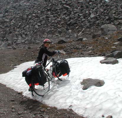
Watchman Lookout
I should know these!
DAY 61 Crescent to Bend 84.89 km JUNE 29/ 01 FRIDAY
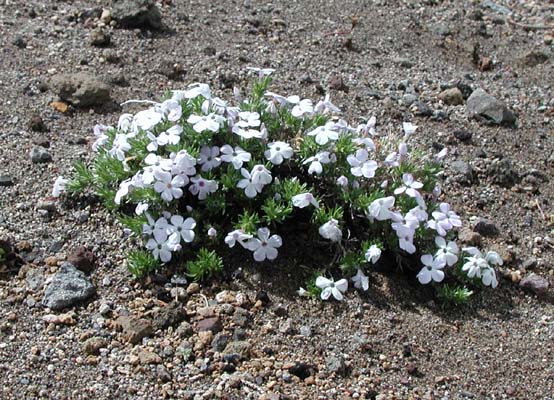
Woke up to a clear crisp morning... 5C. Warmed up rapidly as the sun came up 15C by the time we left camp at 8am. This high desert is really amazing me. I guess we took about it at some time in school.. must have been a while ago as those brain cells have been erased and reused. The temperature swings are phenominal...they get freezing every month of the year, have virtually no flowers at this time anyway. Knowone has a planted garden with flowers so it makes for a sort of bland scene, yet the vegitation has different hues to it and shapes to make it interesting. The amount of snow they get sure surprised me... the ski hill here..Mt Bachelor might be worth coming down to for a visit.
A must for our next ride are ear plugs.... are they legal to wear when your riding on a highway? Hwy 97 is nothing traffic wise compared to I 5, but constant noise. The shoulder is adequate, the drivers good, the grade very gradual up,down. There is a lot of empty spaces here. Almost out of water and no waysides or gas stations or small towns to refil. Got to 30C once again.
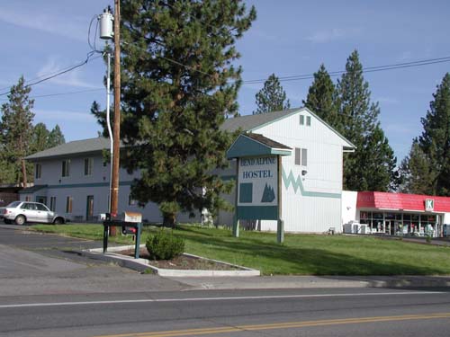
Arrived in Bend early and behold it's not raining, we're not exhausted, just decided to spoil ourselves and stay in the "youth" hostel. I have been craving "regular" food... maybe not to some.. but we had terrific veggie wraps for lunch and I made my favorite broccoli rice casserol for supper....YUM! I think I'll make another day. The host let us use the phone line so internet access once again. (SIL Paula is quite a cyber gal!!) We went to a Outlet Mall... great prices.. how could I say I brought a North Face ski jacket with me! and where would it fit? Could mail it! ($125US for a gortex 3way)
84.89 KM 4hr33 min ride time M 40.1 A 18.5 TD 4492.41KM OD 7951.7Sisters Mountains
High Desert
Hostel in Bend
DAY 62 Bend to Culver KOA 62.89 km JUNE 30/ 01 SATURDAY
Today we are thinking of Ken's Mom as it is her ... Birthday... it looks like a nice day at 6am. Don't have any plan of a destination so far.... just hit the road. Bend was a cute town with lots of small old homes refurbed.
We headed off from Bend on the Old Bend/Redmond Hwy. It was a lovely route rolling thru acreages but had "cracks" across every 15 ft so amazed the computer still works! The views of the snow covered mountains to the west over the farms was really nice. Llamas, ostrichs and goats are along our way. We just pedalled along looking at everything... the afternoon was on Hwy 97 for the later 20k which was busy with Saturday traffic.
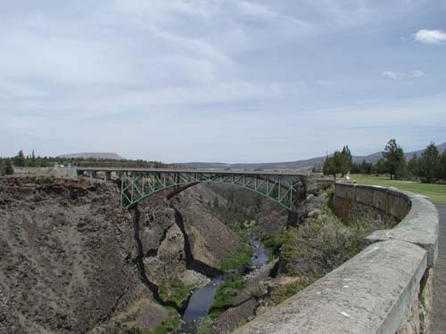
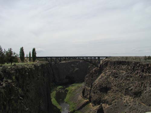
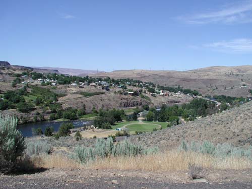
We stopped to explore the Crooked River Gorge where there is the railway bridge, the original road bridge and a new bridge with an >300ft gorge below...and they cann't put a bridge over lake Okanagan!! These bridges are secured to the edge of the gorge. I'm not sure what happens in an earth quake. We stopped early at a KOA for a swim and afternoon by the pool in the sun. We all know I don't enjoy that ...much! Boy we are getting lazy... but I have a feeling more hills are in our future soon. No road sounds tonight! View of a lovely farm and hills.
62.89KM 3hr 42min ride time M43.9 A 16.9 TD 4555.30KM OD 8014.6Mountains over farms
Old bridge and new bridge over Crooked River
Train bridge over Crooked River
DAY 63 Culver KOA to Maupin 96.73 km JULY 1/ 01 SUNDAY
Awoke to a clear sky CANADA DAY. Thoughts are of family in Peers at the family reunion. We had expected to hit a town before camp, but didn't so no breakfast in camp. Set off for Madras 16k before a grocery found. Oh well...stocked up for tomorrow too!
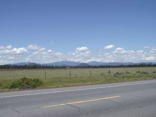
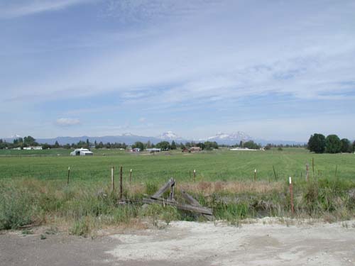
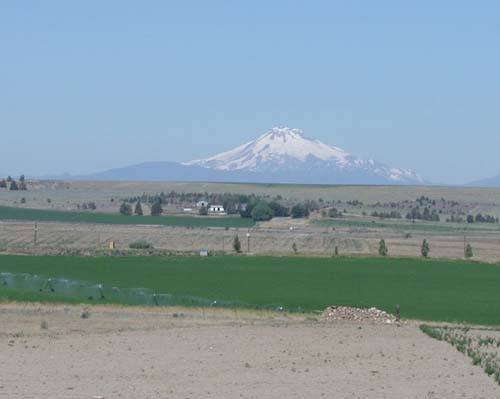
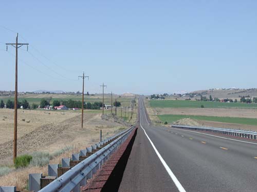
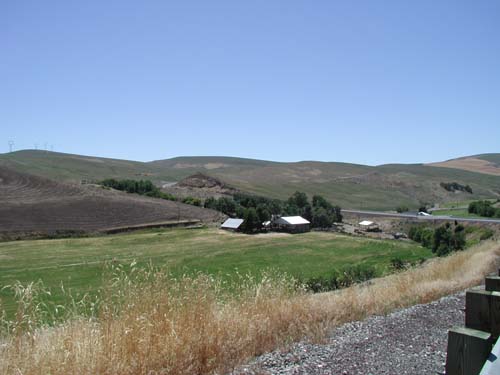
Crops are in where irrigated once more (potatoes, garlic, alphalfa, hay) Just amazing the large mountains that are to the west. They don't look like they belong there as they are spread out 1 then another one. Mt Hood (11000ft), Mt Washington, Mt Jefferson, Broken Top, 2 sisters, Mt Adams very visible to our west. The terrain changed as we started to increase in elevation to Cow Canyon to 3300ft. The sage brush has a greener hue, but everything looks dead. Saw a deer... It must have a tough tongue to be able to eat the stiff grass along here. R2 Ranch runs all along our route... not sure if that is one owner or public grassing land... don't know what they are grazing on.
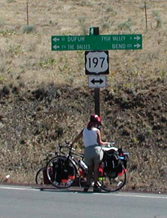
We left 97 on 197 and left all the traffic behind. It was lovely especially when we started our decent into Maupin....8miles of ~4%down then 2 miles of 6% down; felt great after the up in the heat (28C) White water rafting is the main business of Maupin on the Deschutes River. The valley was much hotter than up higher. We will be going up out of here first thing tomorrow hoping to spend July 4 in Hood River which was suggested to us by some "bikers" from The Dalles. We have only seen one other 2some touring this route..?not sure the reason. We are finding the hills ok, the heat a bit much, to keep up the hydration a challenge, and the wide open spaces a surprise. Who knows what tomorrow will bring... besides the huge hill out of here!!!
96.73KM 5hr 22min ride time M49.1 A 16.4 TD 4652.03KM OD 8111.3Mount Hood
Looking back at Madras hills
Interesting Corner posts
View from Cow Canyon Rest Area
Town of Maupin
DAY 64 Maupin to Memaloose(Columbia Gorge) 99.56 km JULY 2/ 01 MONDAY
Started our climb up and out of Maupin at 07:30. The grade wasn't to bad until we went 8km up and 8km down into Tygh valley.(many hills today!!) Arrived in The Dalles hoping to camp there. But after a little riding back anf forth we found out the only campground was RV only.
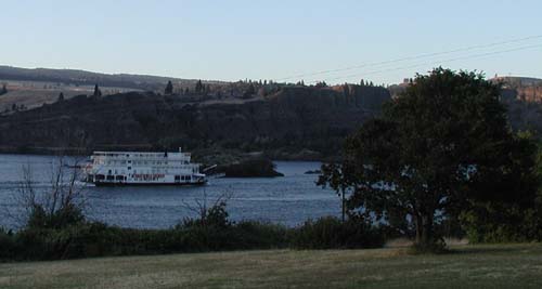
Got some information at the visitor bureau and were able to make reservations for the 3rd and 4th at a hotel in Hood River (We are treating ourselves to a little luxury for the 4th of July celebrations) http://www.gorge.net/lodging/HRHotel Headed out on highway 30 (west into the wind) towards Rowena and then onto the Freeway(84) to get access to the campground. The campsite is very nice right on the Columbia River. The nice couple next to us came by and offered us ear plugs, not because they snore, but because there are train lines on both sides of the Columbia and Hwy 84 is also within hear shot. The day was very hot 30+ with a hot head wind so we are exhausted. These long days are taking a toll.
99.56 KM 7hr 6min ride time M41.4 A14 TD 4751.59KM OD 8210.9Miles from Where?
High Desert farm
Columbia River from Hwy30
Columbia Queen passing our campsite
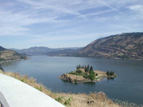
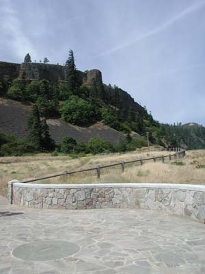
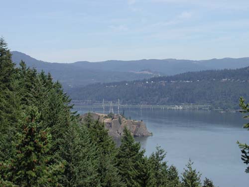
DAY 65 Memaloose(Columbia Gorge) to Hood River 19.00 km JULY 3/ 01 TUESDAY
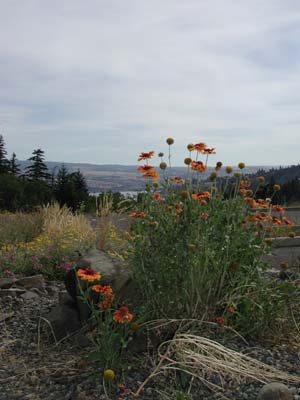
Slept a little later (ear plugs work!), walked and took a lazy start to our short day. The sun pops up from sunrise to mid sky almost immediately here. Warm 15C on rising. Body is refreshed and ready to go. The bike route is unaccessible from the campground so Hwy 84 it is to Mosier. From Mosier is a great route of old road closed to motor vehicles for 5 miles of mostly up, thru 2 restored tunnels with a twisty down of 500ft in the last mile to Hood River. The views of the Columbia River are really nice. Lots of local bikers on the trail.
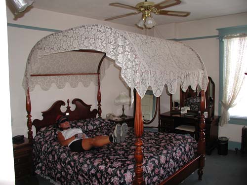
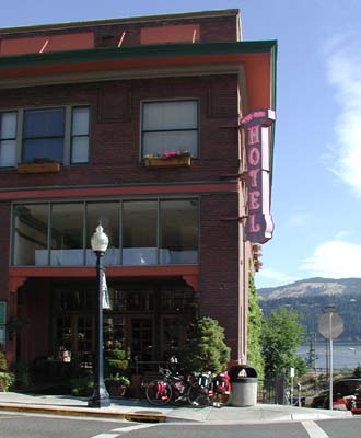
Hood River is a busling town with cars going all directions with bikes and windsurf boards on top and loaded with gear. Everyone looks very fit. Lots of street activity in the down town where we are staying in a heritage hotel that has been completely restored. It is really lovely and not too extravigant. They were very accepting of our strange mode of arrival into their lobby. We looked in shops, lunched and touristed around. Very hot!! Hood River is an older town with lots of neat restored old home on huge lots. Still not a lot of flowers. We had planned on crossing the river here into Washington on the 5th, but it is a car only toll bridge so we will be going back to The Dalles to cross.
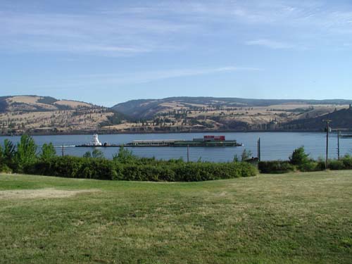
19.00 KM 1hr23min ride time M36.2 A13.6 TD 4770.59KM OD 8229.9Water traffic on the Columbia River
Few flowers along the way
Island on the Columbia
Bike Path to Hood River
Hood River Bridge over Columbia
Hood River Hotel
DAY 66 Hood River Independance Day 0.00 km JULY 4/ 01 WEDNESDAY
Day of luxury! Off to the parade!
Was an experience... small town parade everyone was either in it or watching it. The kids wandered all over the street, no police to keep them back. The entrants threw candies to the kids. It was fun to watch and then we spent an hour in the park listening to local bands. Nice to see families enjoying this day together. Walked to the river and watched the wind surfers... seemed windy to us, but they were waiting for it to "come up" so I guess it gets much stronger. Warm, lazy day with great food. Awaiting the fireworks... don't know if I'll be up til 10pm, but our window looks out to the river and we could see them from here if too lazy to go out. Will head off tomorrow for Washington.
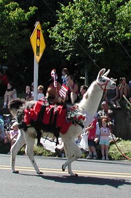
0.00 KM hr min ride time M A TD 4770.59KM OD 8229.9Llama: my next mode of travel
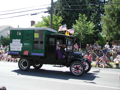
"Antique Motorhome in parade
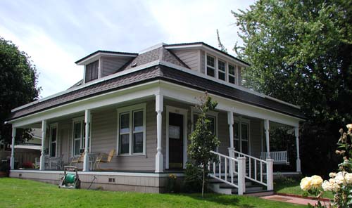
Nice home in Hood River
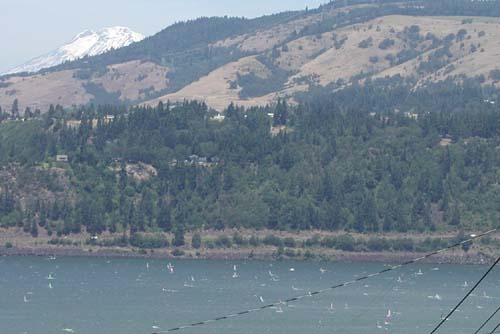
WindSurfers
More windsurfers
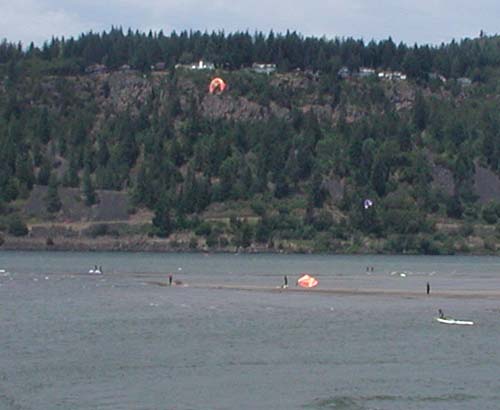
Beach at Hood River
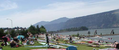
DAY 67 Hood River to Brooks memorial State Park Washington 117.97 km JULY 5/ 01 THURSDAY
I think I left my brains somewhere or I've lost my mind.... I said no more 100k days! Left Hood River with a steep uphill t the bike trail to Moiser, then onto Hwy 30 and up more to Rowena Bluffs. View well worth the sweat! Temp rising (30+) Grass fire on the other side if the Columbia.. where we would have been if the bridge had allowed bikes! The down from the Bluffs takes up a lot of realistate... winds like a snake down, down, down... the wind catches up with us every second turn, but is great at our backs on the others. On to The Dalles and over the bridge into the wind uphill! and no bike lane!! What happened to our bike friendly state! 5km of tough riding and hit Hwy 14 turned north east and the wind hits us more on the back and side. Not anything like the Astoria bridge crossing of the Columbia 6weeks ago.... where did the time go!
Rolling, hot and dry with tail wind and light traffic. No inhabitants either. Stopped at Cascade Cliffs Winery.... not for wine, but for WATER!! It is very sparse! Continued until we met up with Hwy 97 again and headed for Goldendale. Camping is non-existant here. The only spot was a open area beside the gas station with a empty pool, dead grass and 4 motorhomes that looked kind of permanent. We decided to go on... with the advise of locals that the State park was 12miles with mostly down hill...NOT!! Up...up...up..... on tired legs. Sighted many a spot just off the road... my partner not into that so on we pedalled-- singing to help get there. He was probably right as a. no shower at the side of the road b. no water either Did arrive to a nice camp with legs that were stretched to the limit with 8 hours in the saddle I'm sure all those things that build up in my muscles were over the healthy limit!!
117.97 KM 7hr 57 min ride time M48.5 A14.8 TD 4888.56KM OD 8347.9View from Hotel
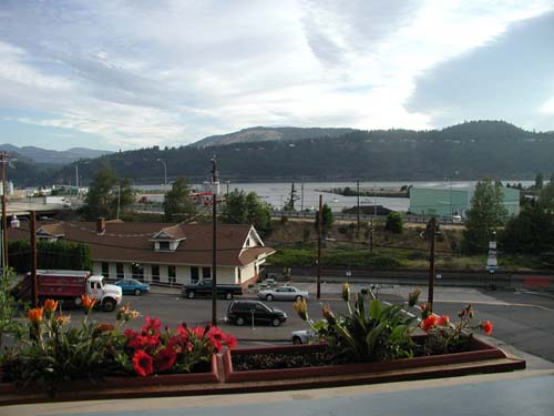
Hood River Hotel
Mosier Twin Tunnels on Columbia River Hwy Trail
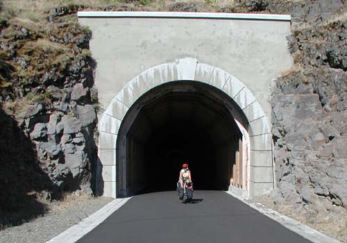
Columbia River
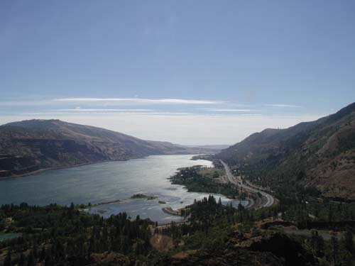
Rowena Crest Loops
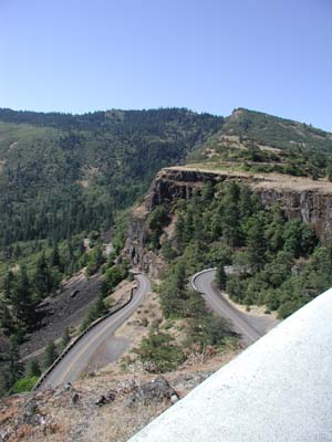
Vineyard on the Columbia