
WASHINGTON STATE TO KELOWNA, BC LOG
DAY 68 Brooks Memorial State Park Washington to Toppenish 65.8 km JULY 6/ 01 FRIDAY
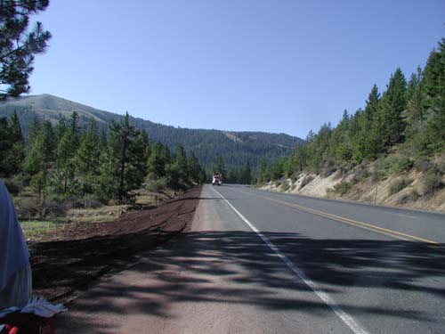
Woke up to a chilly morning (10C). Muscles not yet revived, but no aches, just tired feeling. Headed uphill once more as not to the summit yet. 5k and at 3100ft (The Dalles was 60ft so last evening we really climbed!) Most of day spent rolling hills much like Okanagan, but unirrigated desert on the Yakima First Nations Reservation. No housing seen for 30k. Rubish ++ in the ditches. We are a throw away society.. stuff you never see in the car... DON"T throw anything out the window.. not even an banana peel!! bottles/glass/cans/banana peels/rope/lighters/cig packs/bungie cords by the hundreds/ ken when a truck came too close! There is a refund on drink packages, but you wouldn't know it here. We came upone a spot where there were pennies glittering... we stoped and picked up a couple of dollars in dimes/nickles/pennies. (He won't let me pick up the bottles though!!)
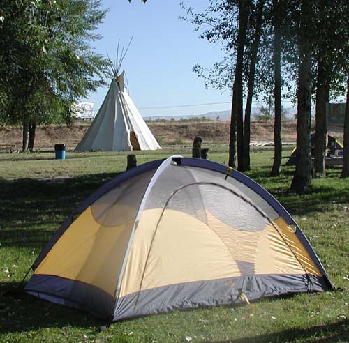
Cherries are in season and we gorged ourselves on a couple of pounds..each! We will be sorry later I'm sure. We came into camp early (1330) at a really nice spot run by the First Nations just outside of Toppenish. This is one of the only prosperous Reserves I've seen... they have a casino, campground, own police, nursing home/housing and most jobs seem to be held by their members...and working hard. There is no alcohol allowed in the campground or at the casino. We went to the buffet dinner at the Casino... not as cheap as in Vegus, but very good.
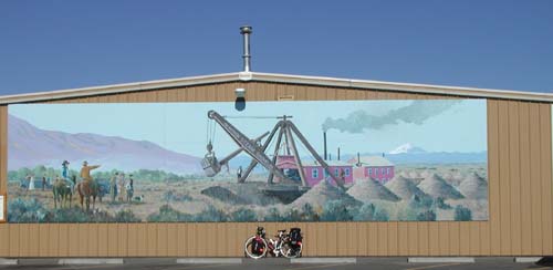
The campground is very modern with a pool, hot tub, sweat lodge and nice rooms for indoor time... tv lounge, games room, and modem phone line. Other campsites could learn a thing or two! Toppenish is known for it's many murals painted on the buildings about town. They are western themes and very well done.
65.87 KM 3hr39 min ride time M46.3 A17.9 TD 4954.36KM OD 8413.8Logging trucks return
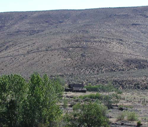
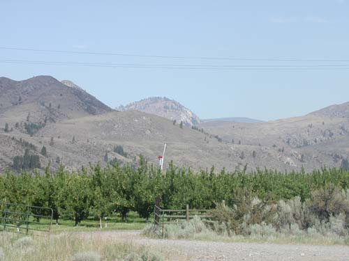
Homestead on Yakima Reservation
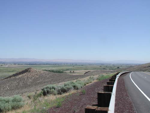
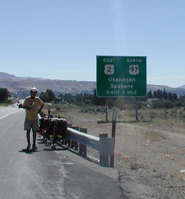
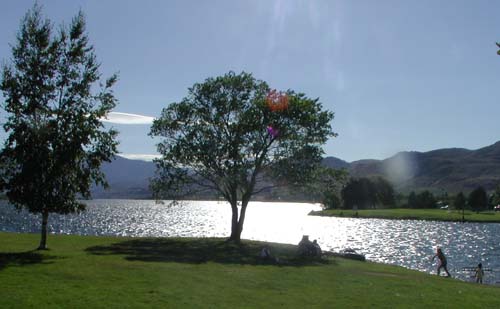
Toppenish Valley
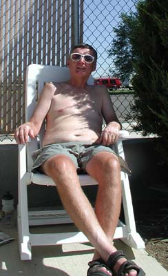
Ken gets to sit by the pool too!
DAY 69 Toppenish to Ellensburg KOA 103.7 km JULY 7/ 01 SATURDAY
Felt really good on leaving this am. on Hwy 97 which had a good shoulder and was divided most of the time, with little traffic as the freeway 82 is a short distance away with all the traffic. Quickly came to Yakima with apple orchards, hop vines, and market gardens all along our way. Stopped at a fruit stand for fresh tomatos...Hot house from B.C.!!
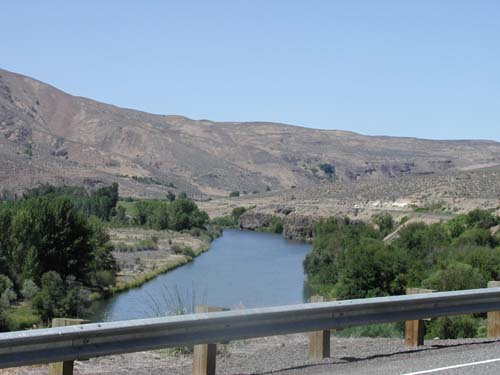
As 97 goes onto 82, we decided to take 821 a Canyon Rd. Lots of up to start then followed the river rolling for 30miles. Lots of people "drifting" the river in rubber dingys or tubes. This is supposidly the best trout stream in Washington. Didn't see any caught, but lots of fishermen. Continues to be very hot (98F) Water hard to come by along this route... none of the day use spots had water. Did get refills from a fellow renting boats/cabins about 1/2way. Kept expecting a huge climb out of the canyon before Ellensburg, but to our surprise rounded a corner and we were out. If we had known we might have tried to camp along the river. $2 to camp, although food was short! The view in the distance from the canyons end is of high mountain peaks... I hope this is not tomorrows route. Did make it to Ellensburg and the only 2 camp spots are: a. one with a motel with hwy82 on one side/truck stop on the other b. KOA with Hwy 90 in the near distance. Opted for KOA even though I dislike them the dip in the pool was welcome and the showers great.
I don't know how many more 100+K days I have in me in this heat... The problem lies in not enough inhabitation here... do you believe it! Who would have thought! Also not a lot of camping... and that there is the locals are not too informed about (nor the visitors info centers) Oh well will get back to remote camping when we get back to Gods Country!
103.7 KM 6hr52 min ride time M44.2 A15 TD 5058.06KM OD 8517.6Yakima Nation RV campground
Mural in Toppenish
River along Hwy 821
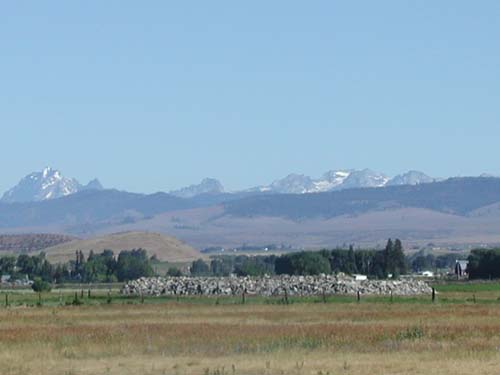
High Mtn Peaks
DAY 70 Ellensburg KOA to Blewett Pass 62.16 km JULY 8/ 01 SUNDAY
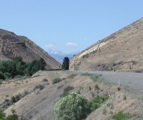
We left Ellenburg and began cycling into a strong north head wind. After a few hours of slow pedaling we got into a more mountainous and treed area so the wind became less of a factor. Decided to take the old Blewett pass road..it was very narrow and full of switch backs but there was virtually no traffic.(a local in Ellensburg had put us onto this route). The summit was 4000ft. As we started to decend we saw people camping anywhere so we pulled into what looked liked a forestry campground but it turn out to be a prospecting club that camped and gold panned along this creek. They invited us to stay over night so we set up camp. The club was made up of employees from Boeing in Seatle. They are here so much they have rented their own port-a-potty.
Had a lovely cool off in the creek and got a look at some of the clubs sloucing operation.
One of the campers told us to camp with other people because the night previous they had sighted a very large cougar (500lbs ?? do they get that big?) and heard it meowing that night. I am not keen to see that large a cat, but they have a doberman so I feel safe enough.62.16 KM 5hr12 min ride time M33.5 A11.9 TD 5120.22KM OD 8579.7
More Mountains to climb
Flower of the day
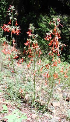
Tenting along the "gold" creek
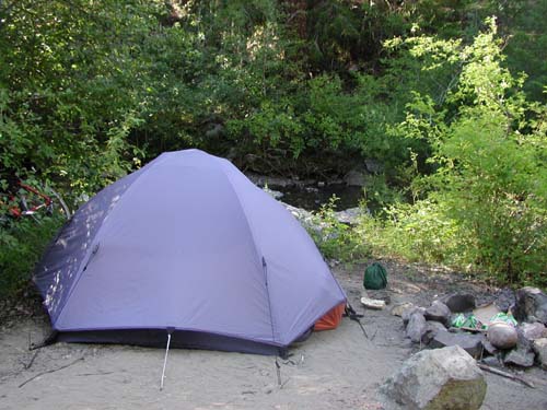
Gold Sluse
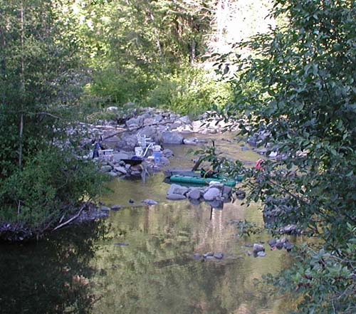
DAY 71 Blewett Pass to Orondo 68.26 km JULY 9/ 01 MONDAY
We got off early about 10K down and got into orchard country. Found a fruit stand that was open at about 8 and had a breakfast of cherries and a nice chat with the owner. They seem to have problems similar to the ALR here. This area is surprisingly like the okanagan - irrigated orchards and all. Picked up our food for the day in Cashmere and were able to avoid going into Wenatchee.
We were planning to go a little farther but we came across a very nice campground (it was also very hot) on Lake Entiat in Orondo. We were able to get a site right on lake so here we are.
We spent the afternoon dipping in the cold lake (a little weedy) and sunning off. Finished another good book and worked on my cross stitch. (almost done!) The weather has been amazing, but I'd rather be by the pool than pedaling in it! Will be soon! Hope the weather in Kelowna has been good and August is it's usual hot month.
68.26 KM 3hr 30 min ride time M48 A19.4 TD 5188.48KM OD 8648.1Getting to the Okanagan oops Okan "O"gan
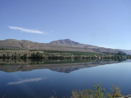
Columbia River
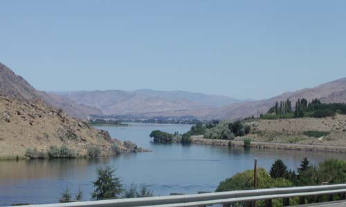
Wierd Clouds
Camp at Orondo
DAY 72 Orondo to Brewster 76.10 km JULY 10/ 01 TUESDAY
Cooled off well overnight. Awoke to another cloudless day. Happy Birthday to BIL David! Temperature bounced up very rapidly to 39C and stayed there all day. Frequent stops for water! Rolling terrain with views of the river to tease us! The road on the other side (alternate 97) seems to run right down by the water until just before the Lake Chelan turnoff when it goes thru a tunnel and up a steep hill. We opted to miss Lake Chelan as the water is low here and the "river" is very weedy and smelly.
We stopped at Wells Dam for a long lunch and rest in the shade. I am really feeling the heat today. Cann't seem to keep ahead of the sweating! We continued on to Pateros where we expected a campsite, but not so. We continued on to Brewster in the sweltering heat and found a city RV park that allows tents. We spent a great afternoon at the river park swimming, sunning and having our supper. We could have been in Mexico, both with the heat and the Spanish being spoken at the beach. This last few days the towns have had a strong Spanish population. The people watching was fun... really cute little kids, lots of families and teens all enjoying themselves. Ken went and watched a local soccer game (+20yrs) and he thought they were very good, but he was the only anglo there.
There are orchards for miles and miles (apples) and little else. The hills are much rockier than Kelowna, but where irrigated seem to grow trees. They are not growing grapes? They are using more modern irrigation than farther south (drip or elevated plastic pipe to each tree) I have decided if a "LAKE" on the map is made from a dam, it is not worth staying at as they are mostly mosquito sloughs. We are very spoiled in Kelowna with such a beautiful lake and camping area. Looking forward to home. It is +30 at 8pm and hoping for a drop overnight.
76.10 KM 4hr 09 min ride time M42 A18.3 TD 5264.58KM OD 8724.2Beach at Brewster on Columbia River
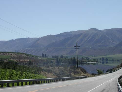
River views along the route
Views
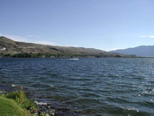
more rivers
DAY 73 Brewster to Tonasket 94.74 km JULY 11/ 01 WEDNESDAY
Go up, Got out of bed...same old same old... well not entirely: Was warm on rising. Other campers were off early to pick cherries. We had a little furry tail waging visitor last night who is stray .. no not Ken.. a cute puppie.
The route has gotten rather boring in that as one piece of sage brush is all one needs to see! The scenery is bland, it's still very hot, but the company remains excellent so I guess I'll keep him! We stopped in Omak at the Library and got news from family and friends. I no longer feel abandoned! With the trip drawing to an end we hope to continue to keep in touch with all our email friends.
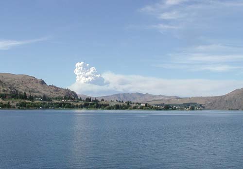
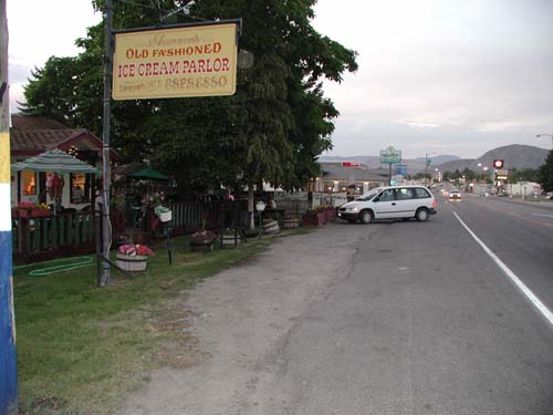
Joined up with Hwy 20 and suddenly seeing other loaded bikes. A couple of boys out 5 weeks from Michigan. Another couple of guys (father/son) headed east are with us at the camp which is in the yard of Shannon's Old Fashioned Ice Creme Parlor. She said she gets about 200 cyclists a season. We saw 5 others at the store, but don't know where they are camped. The local tavern was welcome as it was air conditioned! There was a lot of smoke in the air today as there are a couple or fires burning to the west. They had 4 firefighters die yesterday due to high shifting winds.
94.74 KM 5hr 17 min ride time M45.3 A17.8 TD 5359.32KM OD 8818.9Fires in Valley make a haze
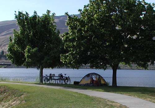
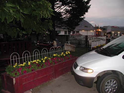
Campsite in Tonasket
Tent site
DAY 74 Tonasket to Kelowna!! 166.09 km JULY 12/ 01 THURSDAY
Up early as our cute campsite turned out to be a bit noisy until 10pm with the dinner crowd and the traffic as usual kept up most of the night. Where do they all go at 3 am?
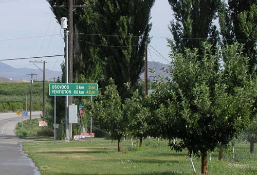
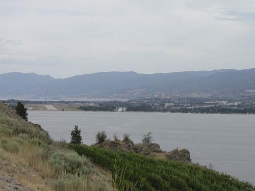
Set off at 7 for Orovill and the boarder. 30km done by 0830 and 29C Seemed a bit cooler with whispy clouds or smoke. Easy railway grade with more dry hills and orchards as scenery. Boarder crossing no trouble and off we went to reach Penticton by noon. The hills are more colorful with the pine trees and more yards have flowers and shrubs. We made a brief stop to inspect the weedfree gardens in Summerland which Ivan is tending with loving care while Karen is off at the Stampede!
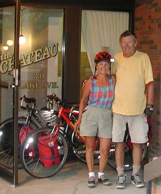
Decided as the thunder clouds were building we would just keep on for Lake Avenue. Amazingly I think both of us have gained some muscles over the past 74 days as Drought Hill wasn't so bad. We were really happy to see our front street was paved once more and the noisy work machines gone! Keys were a bit of a discussion as we didn't have a building key, but a apartment key did get us in. We enjoyed a late evening with my brother Stewart hearing all the family news we had missed at the reunion. We had a wonderful trip and hope everyone who kept contact with us thru email and just reading our adventures is having a great summer. Our Phone is reconnected, but have to reconnect with a few family members before we both return to the "real" world of work. Only long enough to plan our next adventure!!
166.09 KM 9 hr 22 min ride time M44 A17.7 TD 5525.41KM +extras OD 8985.0TOTAL TRIP DISTANCE 5611.95 WEIGHT LOSS ~30LBS guess who!
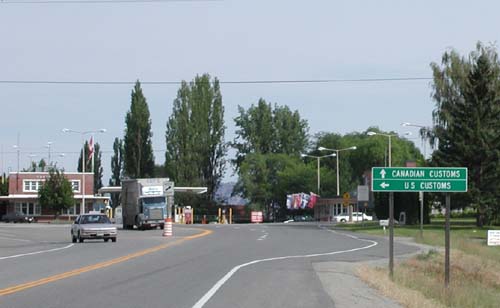
Customs: No Welcome to Canada Sign
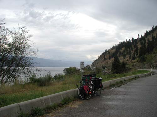
Miles to home!
Penticton in the haze
Above Peachland
WE MADE IT! 5611.95 KM